Australian Firm HEO Uses Satellite Imaging to Reveal Details of Mysterious Chinese Test Satellite
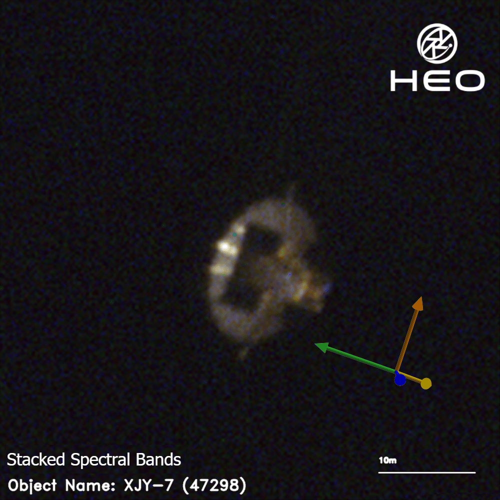
Helsinki – Australian aerospace company HEO announced that it has successfully captured high‑resolution images of an unidentified Chinese satellite during its final orbital pass before re‑entry, allowing the firm to produce a detailed three‑dimensional model of the spacecraft.
The satellite, which entered low Earth orbit earlier this year, has been the subject of speculation among analysts who suspect it is part of a series of technology‑validation missions. HEO’s satellite‑to‑satellite imaging system, operating from its Helsinki tracking station, recorded the object at a distance of roughly 500 kilometres, producing visual data that reveal the vehicle’s external geometry, antenna configuration and likely propulsion layout.
According to HEO, the imaging campaign lasted for about eight minutes and was coordinated with a ground‑based radar network to verify the satellite’s trajectory. The resulting model shows a cylindrical bus with a deployable solar array and a distinctive conical nose section, features consistent with experimental platforms used for testing new communication payloads and autonomous navigation systems.
Industry observers note that the ability to image a satellite from orbit represents a significant advancement in space‑situational awareness, a capability that could be leveraged for both commercial and security purposes. “The data provide valuable insight into the design choices of emerging space technologies,” a spokesperson for a European space‑monitoring agency said, declining to identify the source. “Such transparency helps the broader community assess potential risks and opportunities.”
Chinese authorities have not commented on the specific spacecraft, but a recent statement from the nation’s space administration emphasized its commitment to responsible experimentation and compliance with international guidelines for debris mitigation. The satellite is expected to re‑enter the atmosphere within the next 24‑48 hours, with most of its mass likely to burn up over the Pacific Ocean.
HEO plans to release its full model to academic partners later this month, citing a desire to support open research on satellite design and orbital dynamics. The episode underscores the growing importance of cross‑national cooperation in tracking and analyzing the increasingly crowded low‑Earth‑orbit environment.